6.4. Connect
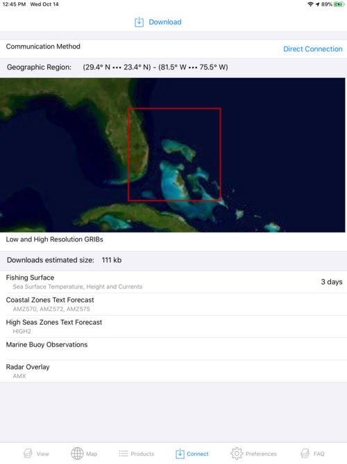
Its on the Connect page where you select your Wi-Fi, satellite or other Communication Method which you will use to download data.
On the Connect page you will also find a summary of:
-
The geographic area you boxed on the Map page; both the box on a local map and the bounding corners of that box.
-
An estimate of the size, in kilobytes, of the data you are preparing to download.
-
A summary of the GRIB data and other data layers in your pending download. If other data layers have been selected, this summary will provide the short code names of the associated coastal, offshore and high seas forecasts and radar overlays. Short codes are not presented for buoy data.
