3.1.1. Text Layers
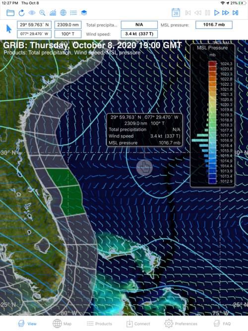
If Coastal and/or Offshore Text Forecasts are tagged, the locations of each area will appear on your View screen as transparent shapes tracing the coastline and/or offshore. If a shape is colored light green, you have downloaded a text file for this location and the data is current (less than 6 hours old). If the shape is colored red, the data is older than six hours.

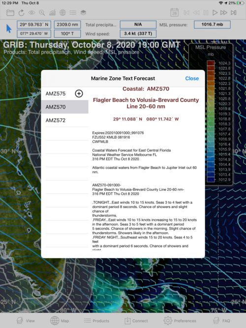
Tap on any transparent green shape and the text forecast for that location will appear as a pop-up.
To the left of the actual text forecast in the pop-up will be a list of other text forecasts that also have been downloaded. Double-tap any of these other forecasts to view it.
NOTE: Do you see a + next to text forecast id in the list of text forecasts? This means you can add this text forecast to your next download by simply tapping on the +
